


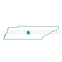
20-1 Creekmont General Baptist Church Voting District, Rutherford County, Tennessee
About
Outline

Summary
| Unique Area Identifier | 669456 |
| Name | 20-1 Creekmont General Baptist Church Voting District |
| County | Rutherford County |
| State | Tennessee |
| Area (square miles) | 7.97 |
| Land Area (square miles) | 7.96 |
| Water Area (square miles) | 0.01 |
| % of Land Area | 99.87 |
| % of Water Area | 0.13 |
| Latitude of the Internal Point | 35.91218110 |
| Longtitude of the Internal Point | -86.48435810 |
Maps


Graphs
Select a template below for downloading or customizing gragh for 20-1 Creekmont General Baptist Church Voting District, Rutherford County, Tennessee


Neighbors
Neighoring Voting District (by Name) Neighboring Voting District on the Map
- 03-4 Florence Baptist Church Voting District, Rutherford County, TN
- 08-1 Blackman United Methodist Church Voting District, Rutherford County, TN
- 09-1 Stewart Creek Elementary Voting District, Rutherford County, TN
- 10-2 Stewartsboro School Voting District, Rutherford County, TN
- 20-2 Blackman Middle School Voting District, Rutherford County, TN
Top 10 Neighboring County Subdivision (by Population) Neighboring County Subdivision on the Map
- District 10, Rutherford County, TN (16,878)
- District 20, Rutherford County, TN (16,296)
- District 8, Rutherford County, TN (14,479)
- District 9, Rutherford County, TN (13,763)
- District 3, Rutherford County, TN (12,027)
Top 10 Neighboring Place (by Population) Neighboring Place on the Map
Top 10 Neighboring Elementary School District (by Population) Neighboring Elementary School District on the Map
Top 10 Neighboring Secondary School District (by Population) Neighboring Secondary School District on the Map
Top 10 Neighboring Unified School District (by Population) Neighboring Unified School District on the Map
Top 10 Neighboring State Legislative District Lower Chamber (by Population) Neighboring State Legislative District Lower Chamber on the Map
Top 10 Neighboring State Legislative District Upper Chamber (by Population) Neighboring State Legislative District Upper Chamber on the Map
Top 10 Neighboring 111th Congressional District (by Population) Neighboring 111th Congressional District on the Map
Top 10 Neighboring Census Tract (by Population) Neighboring Census Tract on the Map
- Census Tract 403.02, Rutherford County, TN (8,311)
- Census Tract 423, Rutherford County, TN (7,358)
- Census Tract 408.06, Rutherford County, TN (6,608)
- Census Tract 408.08, Rutherford County, TN (6,313)
- Census Tract 408.07, Rutherford County, TN (4,957)